Thank you 2026 Society Champion Sponsor
|
thank you 2026 Leadership Sponsors
|


ISPLS Logo Store - Click Here to Customize Items
|

About ISPLSThe Idaho Society of Professional Land Surveyors is the foremost leader in support of professional land surveyors in Idaho. | MissionTo advance the science of land surveying and foster and maintain high standards of professional ethics and practice. | HistoryISPLS was incorporated in 1976. The name was changed in 1993 to Idaho Society of Professional Land Surveyors. |
| The Idaho Society of Professional Land SurveyorsLand surveyors in Idaho were first organized as a subsidiary of Idaho Society of Professional Engineers. In 1974, the Land Surveyors of Idaho organized as separate entity. The group incorporated In 1976 as a non-profit entity called the Idaho Association of Land Surveyors. The name was changed in 1993 to Idaho Society of Professional Land Surveyors. |
Upcoming Events
|

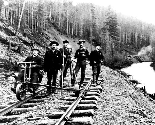
Land Surveying
Land surveying has a long and storied past. In relatively recent history, in 1803 Merriweather Lewis and William Clark were directed by United States President Thomas Jefferson (who was himself a surveyor) to investigate the Pacific Northwest in search of the Northwest Passage:
“… The object of your mission is to explore the Missouri river, & such principal stream of it, as, by it’s course & communication with the waters of the Pacific Ocean, may offer the most direct & practicable water communication across this continent, for the purposes of commerce. Beginning at the mouth of the Missouri, you will take observations of latitude & longitude, at all remarkable points on the river, & especially at the mouths of rivers, at rapids, at islands & other places & objects distinguished by such natural marks & characters of a durable kind, as that they may with certainty be recognized hereafter. the courses of the river between these points of observation may be supplied by the compass, the log–line & by time, corrected by the observations themselves. the variations of the compass too, in different places, should be noticed. … Your observations are to be taken with great pains & accuracy, to be entered distinctly, & intelligibly for others as well as yourself, to comprehend all the elements necessary….” – Excerpts from the diaries of Thomas Jefferson |
|