

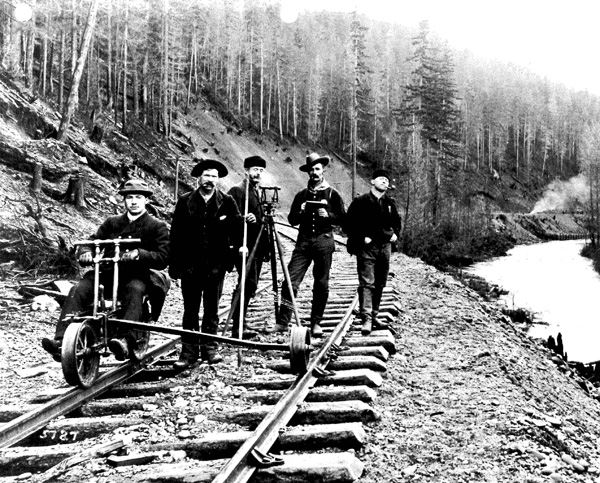
Land surveyors in Idaho were first organized as a subsidiary of Idaho Society of Professional Engineers. In 1974, the Land Surveyors of Idaho organized as separate entity. The group incorporated In 1976 as a non-profit entity called the Idaho Association of Land Surveyors. The name was changed in 1993 to Idaho Society of Professional Land Surveyors.
| The Idaho Society of Professional Land SurveyorsLand surveyors in Idaho were first organized as a subsidiary of Idaho Society of Professional Engineers. In 1974, the Land Surveyors of Idaho organized as separate entity. The group incorporated In 1976 as a non-profit entity called the Idaho Association of Land Surveyors. The name was changed in 1993 to Idaho Society of Professional Land Surveyors. Objectives of ISPLS stated in the Articles of Incorporation are to:
|
JOIN ISPLS
|
| MEMBERSHIP |
Land Surveying
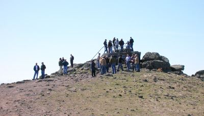
Today, the ISPLS is active in the surveying community of Idaho. Our quarterly publication keeps members apprised of activities and issues of interest to the profession. The annual conferences that we plan, organize and execute provide speakers and coursework that offers license holders the opportunity to gain all of their necessary Professional Development Hours in one place, as well as connecting with others in the profession. We host governors for the regional organization Western Federation of Land Surveyors, and the national organization National Society of Professional Surveyors to represent the state and to report back on larger issues. We are active in the legislature, working to pass bills that affect our profession.
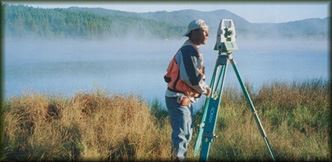
Surveying in Idaho TodayIdaho Law states that only a Professional Land Surveyor is authorized to survey land for the public. The Idaho Board of Professional Engineers and Professional Land Surveyors lists all license holders on its web site found HERE. Requirements for obtaining Professional Land Surveyor status in Idaho are:
|
CommunityThe efforts of the society on behalf of students entering the field are represented by our fundraising for scholarships: in 2010, we awarded over $8,000.00 and provided for every student that applied. Our membership continues to grow and become involved in the society, with members working with students and teachers all over the state on Trigstar and in any capacity that they feel they can contribute. Members are encouraged to be active at the Chapter level and to experience their potential in leadership roles by running for office at the state level. We are a strong community, committed to the ideals of our founders and to the honorable profession of land surveying. |

Types of Surveys
|
Contact Us Mailing Address:PO Box 2133 Phone:208-951-2141 Email: |